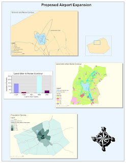
(Click on the map above to see a larger version.)
My experience with ArcGIS was somewhat time-consuming and frustrating (as expected when getting familiar with new software), but overall it was rewarding. The tutorial was very detailed, so I never really had a moment where I thought, "what do I do now?". The main problem I had was with referencing files from the correct drive. I ended up using several drives (my flash drive, the local workspace, and the shared server where the data originally came from) because there was an error where it would not let me select files on my flash drive. I eventually had to just re-do one section, but fortunately it was faster the second time, and gave me some more practice. I did have some fun in the end while customizing the color scheme and layout of my map. Overall, I can tell that this software has a lot of potential for creating and editing maps and data, and presenting them in various ways.
I believe that both the main potential and pitfall of ArcGIS lies in its complexity. It reminds me of Adobe Photoshop, which I have been using for years. There are a lot of features and a lot of options, and it would take a lot of time and effort to fully utilize all of them. In general, though, the basic functionalities and some of the more straightforward customizations of both ArcGIS and Photoshop are not too difficult to master. So, although ArcGIS is intimidating because it can do so much, I don't think it will be too difficult to make some basic maps with it. It will just be a matter of learning all of the sequences and pathways to accomplish certain tasks.
I think that another potential pitfall of ArcGIS is that it is susceptible to common computer problems and difficulties, such as crashes, misplaced files, and lack of writing permissions on certain drives. I also think that some of my difficulties were partially due to how I normally use Macintosh operating system instead of Windows. One main difference between the Mac and Windows operating systems is that Windows is very heavily reliant on the "path" or "address" of files (Ex. S:\Data\Classes\Geog\Spring2010\Week 4), while Mac is not. With Mac, I can move a file around and even rename it while the file is open, and it will not cause any issues. With Windows, you cannot do that, so I have to get used to paying more attention to where files are, in order to avoid mistakes like the one I made of referencing files in my map from different drives.
It is quite clear that ArcGIS has a lot of potential. The presentation at the beginning of lab section demonstrated some of the quite impressive maps and charts the program can produce. I was especially intrigued by the 3-dimensional elevation map of a mountain range, since I thought ArcGIS only functioned in 2 dimensions. I'm sure 3-D files will be more difficult to work with, but the results do tend to be more interesting. I am also interested in exploring all of the different visual options in ArcGIS, such as changing color-schemes and layouts.
Nice job.
ReplyDelete9.8/10